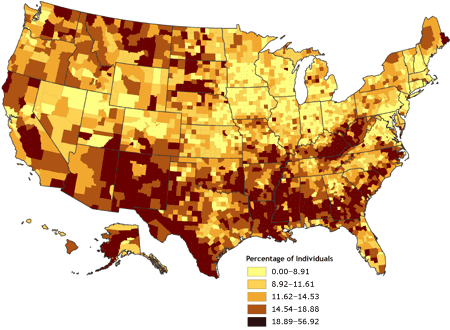
Below is an image of a Choropleth map which illustrates the population of individuals who are living in poverty. These map types are useful in displaying the average number of variables such as populations in specific area.
 http://www.cdc.gov/pcd/issues/2007/oct/images/07_0091_02.gif

No comments:
Post a Comment