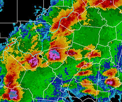
Below is an image of a Doppler radar map over Louisville, KY. These map types are useful for illustrating the movement and patterns of weather conditions such as rain, wind, and other storm types.
 http://www.crh.noaa.gov/images/lmk/soo/Radar_Web_Images/CompRef_2125z_2Mar2012.png
No comments:
Post a Comment